
Eastern Washington Orienteering Club
Using A Compass With A Map
The Orienteering Map
This page, and the ones that follow, will describe the peculiarities of an orienteering map and show you how to efficiently use a compass with one. Download this PDF copy of the map we're using, and print it out if you want the full hands-on experience.
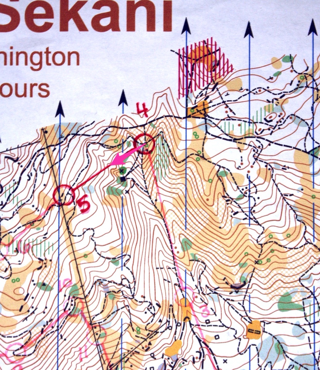
In our lesson, we're going to imagine that we are at control point 4 and want to follow a compass heading to control 5.
Bonus Details
- The distance between magnetic north lines is consistent (often 250 meters, real world) so that you can estimate distances quickly
- Compasses point to magnetic north. In Spokane that means your compass will point about 14-1/2 degrees east of true north (the line that streets generally correspond to). That "error" is known as declination — as in "14-1/2 degrees east declination."
- The declination varies by region, and slowly over time. 40 years ago, the declination in Spokane was about 5 degrees greater.