• Events
  • Results
  • Venues
    • Camp Sekani
    • Eastern Washington University
    • Farragut State Park
    • Finch Arboretum
    • Fishtrap
    • Gonzaga - Jepsen Start
    • Gonzaga - Standard Street Start
    • High Bridge Park
    • Holmberg
    • Liberty Lake
    • Lincoln Park
    • Manito Park
    • Mirabeau Park
    • Mount Spokane
    • Riverside School
    • Riverside SP - Bowl and Pitcher
    • Riverside SP - Camp 7-Mile
    • Saint Georges School
    • Saltese Uplands
    • Sandpoint
  • FAQ
  • Contact
  • Walk-thru
  • What is this?

EWOC

E.W.O.C. orienteering flag logo
  • Events
  • Results
  • Venues
    • Camp Sekani
    • Eastern Washington University
    • Farragut State Park
    • Finch Arboretum
    • Fishtrap
    • Gonzaga - Jepsen Start
    • Gonzaga - Standard Street Start
    • High Bridge Park
    • Holmberg
    • Liberty Lake
    • Lincoln Park
    • Manito Park
    • Mirabeau Park
    • Mount Spokane
    • Riverside School
    • Riverside SP - Bowl and Pitcher
    • Riverside SP - Camp 7-Mile
    • Saint Georges School
    • Saltese Uplands
    • Sandpoint
  • FAQ
  • Contact
  • Walk-thru
  • What is this?

Eastern Washington Orienteering Club

High Bridge Park

Notes about our High Bridge map

The High Bridge map actually covers four parks: High Bridge Bluff, Spokanimal Dog Park, People's Park, and Centennial Trail Park. The area is at the bottom of a rather deep valley carved by The Spokane River and Latah Creek. Part of it is grassy parkland, but most of it is natural pine forests with informal trails throughout.
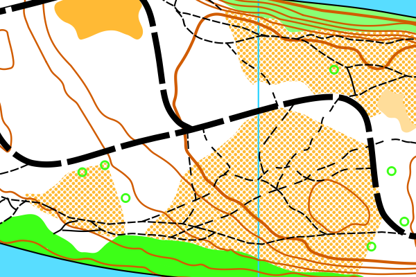
Stacks Image 8939
Scale: 1:10,000 (1cm=100m)
© 2024 Tracy Schoenleber